We decided to go to a beautiful place past Sproat lake in the Clayoquot area (Port Alberni) called 5040 and Triple peak.
5040 Peak is on Vancouver Island and is a premier sunset destination offering 360-degree top-of-the-world views of nearby Triple Peak and Cobalt Lake, often accessible with a challenging 6.9 km hike (in and out). It is a top spot for combining an intense hike with a scenic, high-altitude, overnight camping trip and is accessible via a 4×4-only forest service road (Marion Creek FSR).
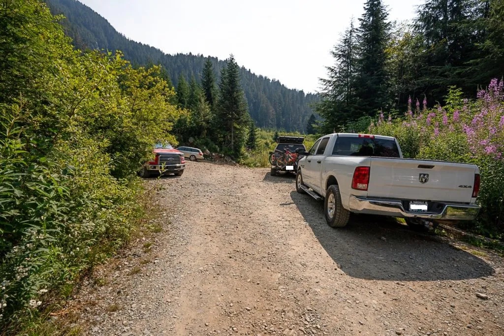
Our hike began one early morning in June; we left Victoria at 4 am headed north to the Pacific Rim highway past Sproat lake and arrived at the gravel road by 7:30. Having the 4×4 truck we were able to get to the 9.6km marker at the trailhead. The forest service road was pretty well maintained but it does have some large potholes in it. A car can make it about 5 km into the road before they got worse as we proceeded along. As we began driving up a steeper part of this road is where cars would have a tough time if can pass at all, we passed several cars that couldn’t make it and were parka long the side of the road, making it narrow to pass. Having to stop here would easily add 4-5KM to your hike, but not for us we carried along in the truck!
As we were driving past the small bridge, we found a couple heading our way so we offered them a ride in the back of the truck. Arriving at the trailhead is wonderful since the climb to the hut is a grind, adding extra walking is just silly. There is a small lot to park, and this day being so warm we actually got the last spot in the parking area. It was already 25 degrees and going to be a hot one. We left two small bottles of prosecco in a cooler in our truck for our return celebration….
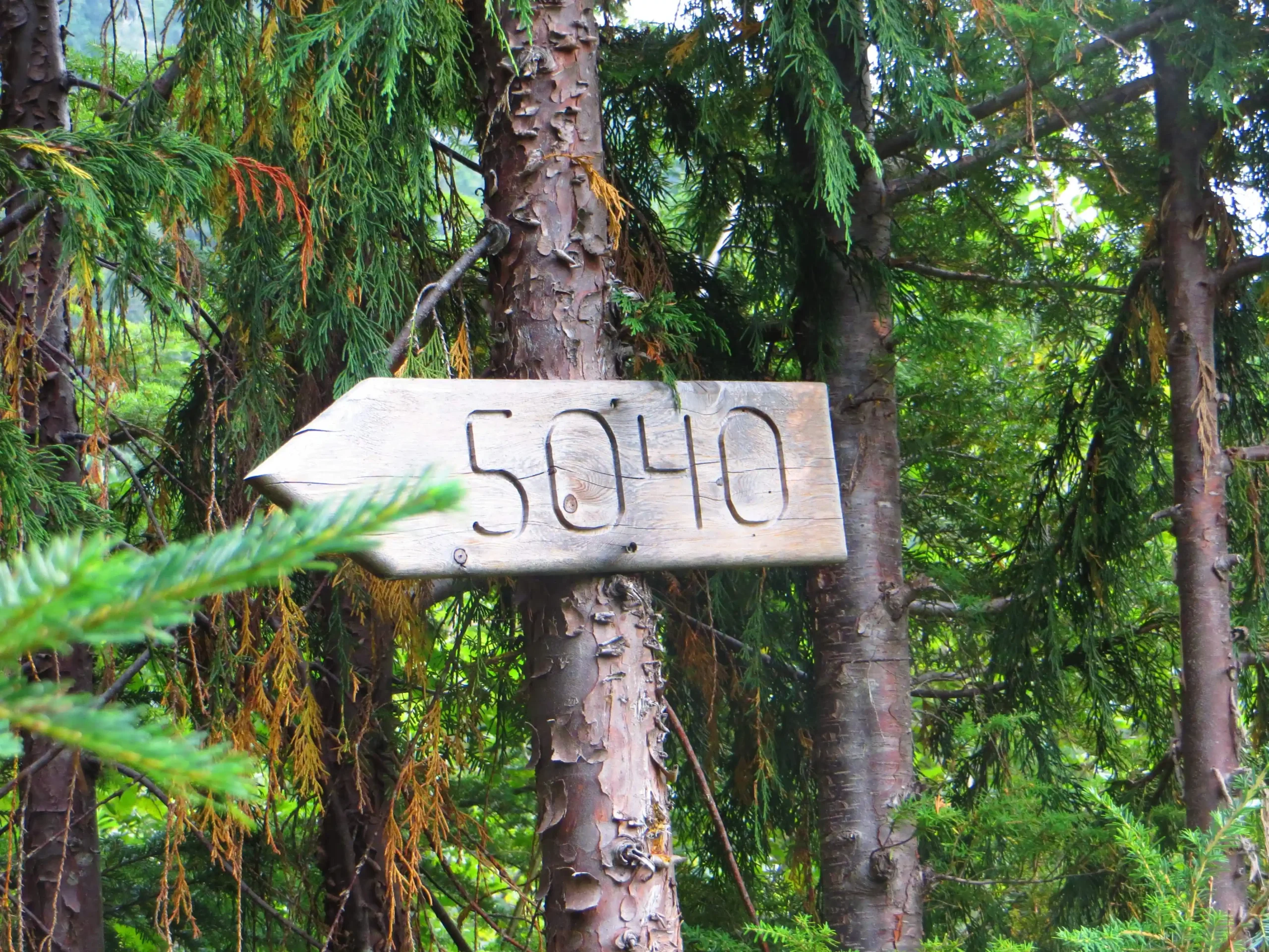
The trailhead is marked with a small undaunting sign, but don’t let the smallness fool you, the adventure your about to embark on is hard but so worth the grind.
The climb begins with a stroll through some small trees and large shrubs mixed with salmon berries, ferns, poplar trees. Meandering up and down before a undaunting incline arrives which progressively gets steeper and steeper. Pretty soon you are using your hands climbing roots which resemble twisty steps up a sharp incline through the cedars, pines and fire trees. The hike is only 1.6KM to the lake and another 1.5 to the summit, no big deal, right?
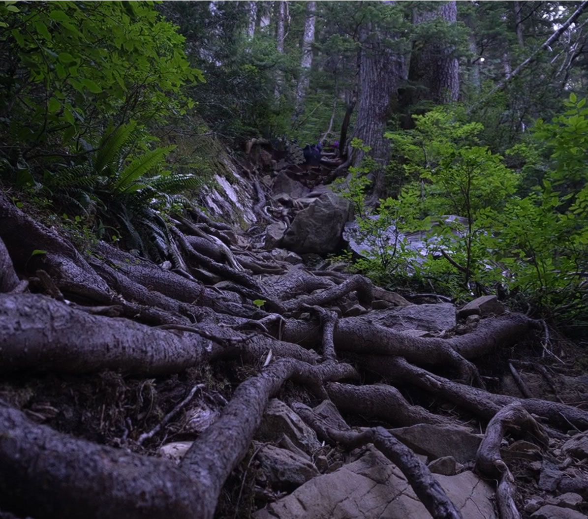
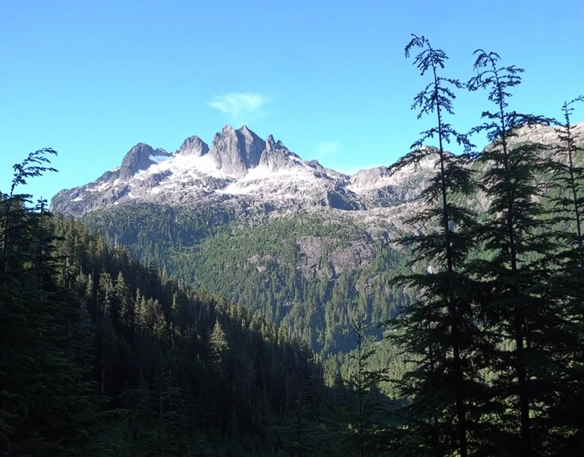
As you climb the root staircase you will be offered glimpses of Triple Peak Mountain, which is an amazing day hike from 5040’s cobalt lake. There are times you can see exactly how remote this area is, even though it feels so close to civilization.
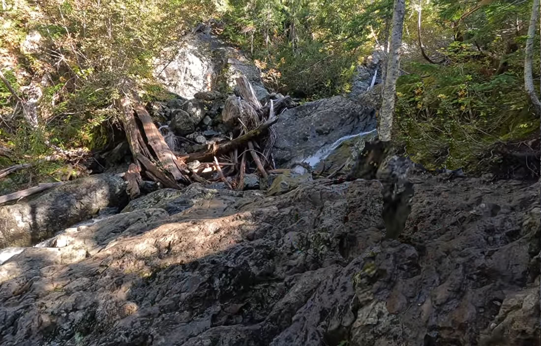
Your first water/breath catch break will be a small cascading waterfall along the trail. This small creek runs along the remainder of the trail up to Cobalt Lake. You can fill your water bottles using it along the way, drink plenty there’s no water shortage to the lake from here. Filtering (LifeStraw) is highly recommended, there are bears and other wildlife (including humans) who use this water, drinking from it without filtering is not recommended.
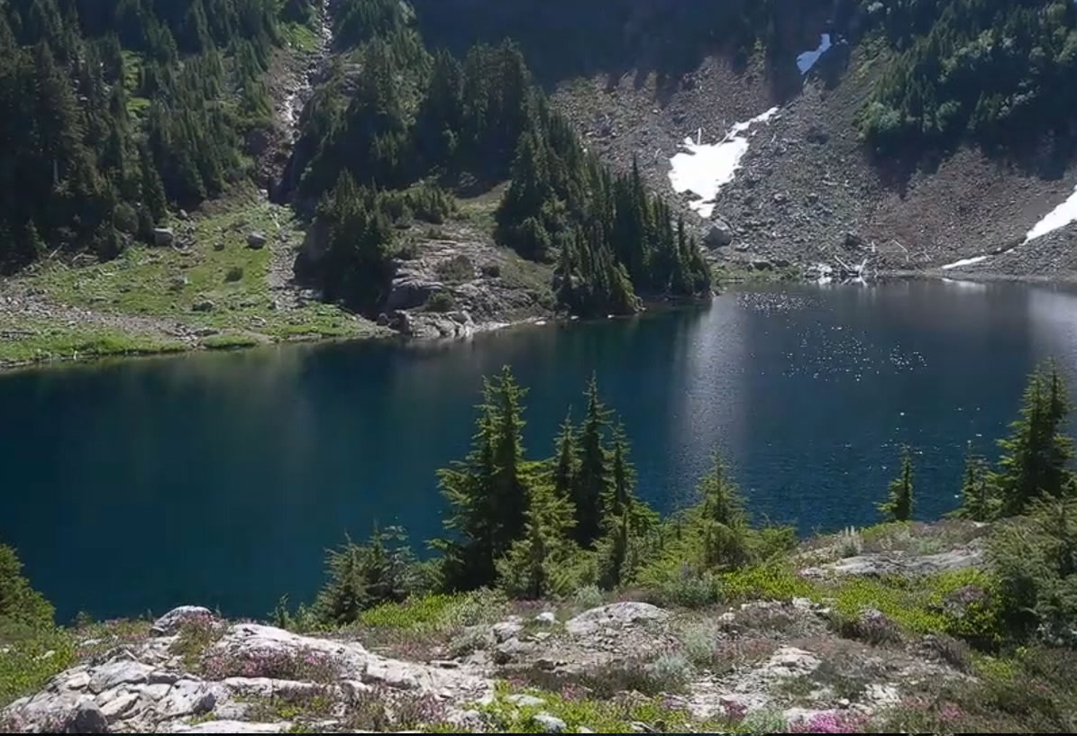
As the rock face opens it signals you are getting closer to Cobalt Lake. This lake is cold but a beautiful green lake, naturally a swim is traditionally what you do when you get here, and it is easy to get out. There are bear caches (lots of black bears hang out here depending on time of year) and plenty of spots to camp here, but the bugs are pretty intense also. We saw two black bears hassling tents and tried to ask people we saw at summit if it was there’s. finding a woman and her younger child who said it was. They figured they had left some food in it which is why the bears were knocking it around.
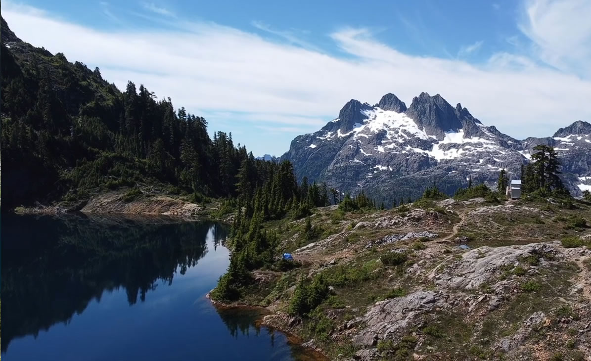
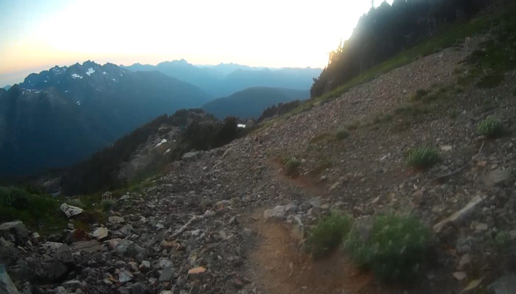
Cobalt lake is at about the halfway point, so many people setup camp here and day hike to the hut and summit. Although many say the hike from here to the summit isn’t as bad, it was every bit for us because we were intent on camping at the summit, so we had to get our packs the rest of the way up. But after all we were halfway, how bad can it be so why not carry on? The steep tree lined path continues to wander up straight the steep mountain until finally it opens to a glacial slide, where you can see the hut sitting proudly ahead.
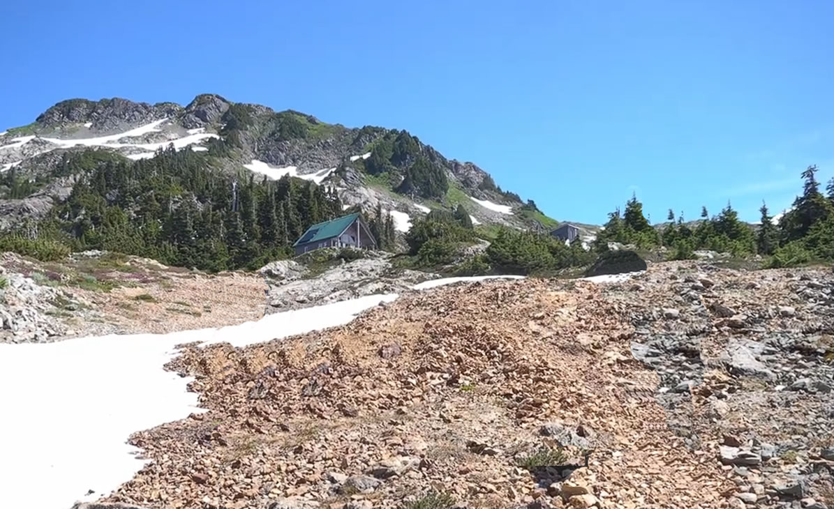
The hut is maintained by the Alpine Club of Canada and is rentable through their site. Yes, it would probably be comfortable, less to carry with no need for sleeping pad, tent, stove, pots and pan, gas etc… but we wanted to enjoy the natural beauty and chose not to book it. Our tent would become our friend form any reason, but mainly because there were lots of mosquitoes and black fly’s in this area, not much wind and lots of standing water. You could hear them dive bombing our tent through the evening.
Carrying along the path you will begin the summit, there is a mix of shale rock, meadow full of flowers and snow and ice as you climb. The trail gets narrow near the summit, and its breathtaking views are easily to distract you, but make sure you’re carefully navigating the trails.
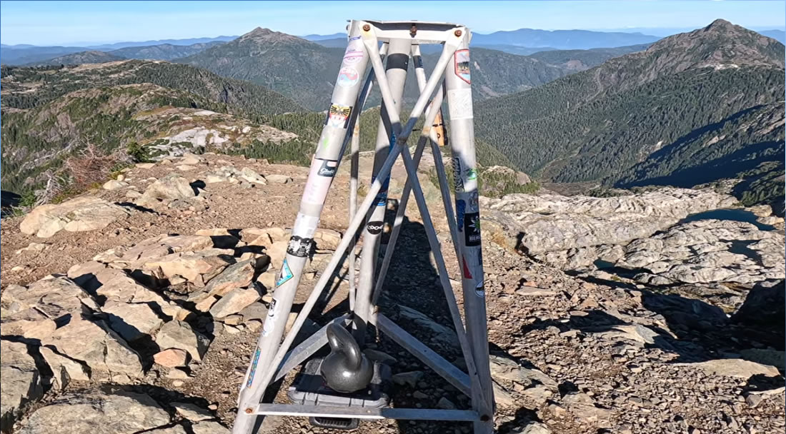
As you approach the summit you will see a small monument, below it is a notepad and a small box full of trinkets. Feel free to write your inspiring story in there for others to enjoy, place a small item there just as other have, or just sit and enjoy your accomplishment in silence.
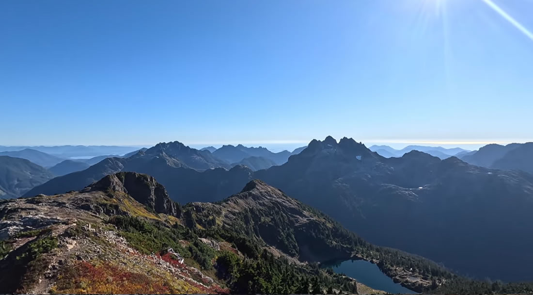
The climb was yours, so you can take whatever time you need to soak it all in. I highly recommend doing this summit either for sunrise, or sunset, those experiences are what this hike is all about. The trip down is pretty exhilarating as well, steep and reversed but not easy by any means. We enjoyed our small bottles of prosecco when we finally made it back and began the drive back, stopping for a swim at Sproat lake campsite on the way home.